INTRODUCTION:
 The
Brufut resort and village (also known as Burfut or Burufut) is
between the Atlantic Ocean and the coastal forest, in Kombo South
District, West Coast Region of The Gambia in West Africa, and
is 23km by road to Banjul capital
and 7km south from Kololi. The old village
is about 1.5 kilometres to the east of the Kombo Coastal Road
and has spread westward to the beachfront to include Brufut
Heights holiday resort and Brufut Gardens residential
community. The other nearby area is Ghana Town founded by Ghanaian
fishermen many years ago. The
Brufut resort and village (also known as Burfut or Burufut) is
between the Atlantic Ocean and the coastal forest, in Kombo South
District, West Coast Region of The Gambia in West Africa, and
is 23km by road to Banjul capital
and 7km south from Kololi. The old village
is about 1.5 kilometres to the east of the Kombo Coastal Road
and has spread westward to the beachfront to include Brufut
Heights holiday resort and Brufut Gardens residential
community. The other nearby area is Ghana Town founded by Ghanaian
fishermen many years ago.
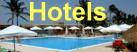
ACCOMMODATION:
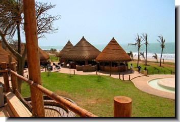
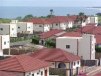
 This
section of the coastal region has undergone rapid development
over the years, a number of hotels
have sprung up to cater for the increased demand for accommodation
located away from the tourist holiday hotspots of Senegambia Strip
and Kotu. In March 2007, the beach based
Sheraton 5 Star Hotel Resort (now the Coral
Beach Hotel) was finally completed and opened for guests. This
section of the coastal region has undergone rapid development
over the years, a number of hotels
have sprung up to cater for the increased demand for accommodation
located away from the tourist holiday hotspots of Senegambia Strip
and Kotu. In March 2007, the beach based
Sheraton 5 Star Hotel Resort (now the Coral
Beach Hotel) was finally completed and opened for guests.
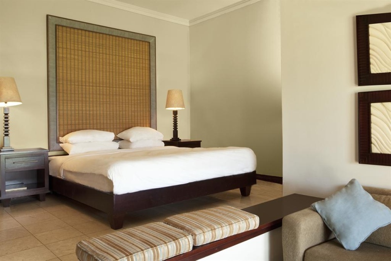
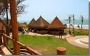
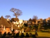
You will find a number of quiet lodges and guest houses located
on the seaside such as the deluxe, boutique hotels called Leo's
Beach Hotel and the Ocean
Villa Heights. Further inside the village itself is boutique
hotel called Hibiscus
House, the much praised, down to Earth boutique lodge called
The Plantation.
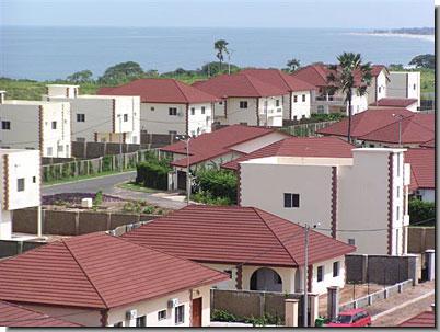
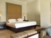
 There
is also the private, fenced and gated housing community called
the TAF Brufut Gardens Estate,
with its modern bungalows, apartments and villas starting on the
coastal road itself. The estate is popular with expatriates and
Gambians living abroad who are looking to purchase a house that
is near the beach. There
is also the private, fenced and gated housing community called
the TAF Brufut Gardens Estate,
with its modern bungalows, apartments and villas starting on the
coastal road itself. The estate is popular with expatriates and
Gambians living abroad who are looking to purchase a house that
is near the beach.
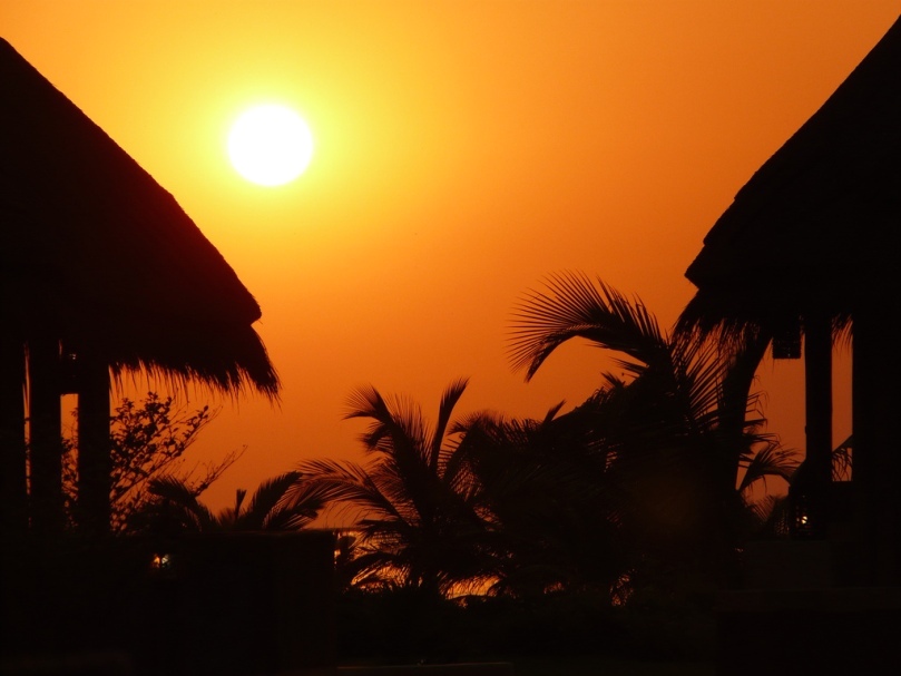
BEACH AREA:
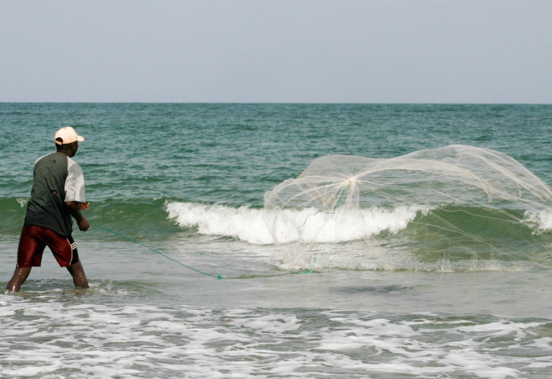
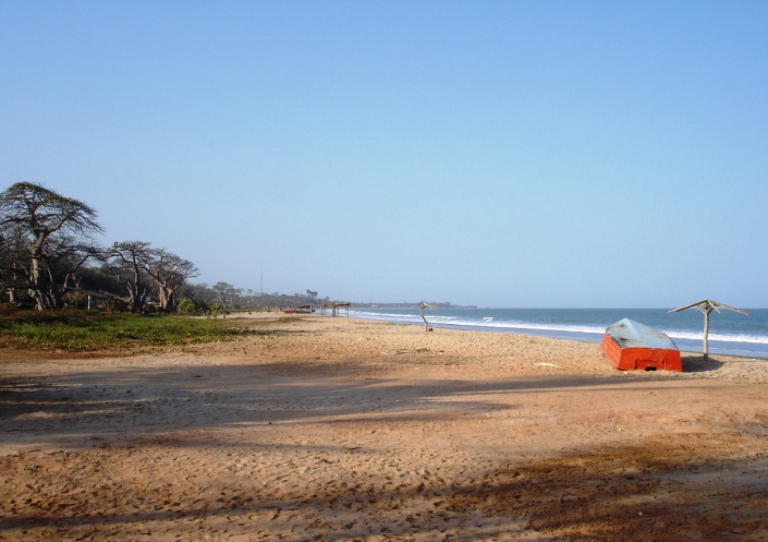
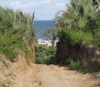
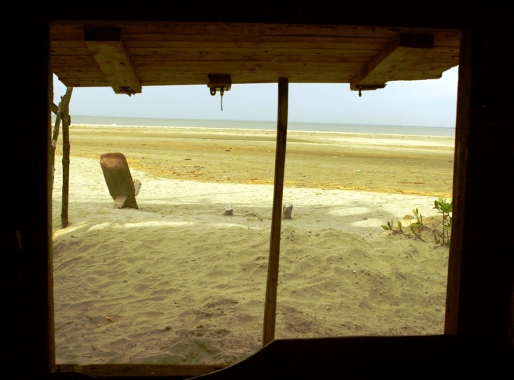
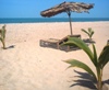
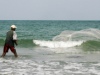
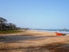
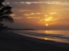
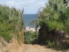
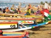
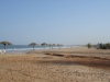 The
Brufut beach area is fairly wide with nice golden sands. To get
to the beach you would need to make your way down the rust coloured
cliffs dotted with trees and bushes using fairly steep paths.
At the palm tree fringed beachfront you might see African pirogues
parked on the sand, waiting for the tide to change, women separating
fish and fishermen repairing their nets. Away from these places,
the beaches are almost deserted, say for a few children playing
or the occasional villager using it as a short-cut. You can use
these sections of the strand for watersports, cycling or sunbathing. The
Brufut beach area is fairly wide with nice golden sands. To get
to the beach you would need to make your way down the rust coloured
cliffs dotted with trees and bushes using fairly steep paths.
At the palm tree fringed beachfront you might see African pirogues
parked on the sand, waiting for the tide to change, women separating
fish and fishermen repairing their nets. Away from these places,
the beaches are almost deserted, say for a few children playing
or the occasional villager using it as a short-cut. You can use
these sections of the strand for watersports, cycling or sunbathing.

GENERAL AREA:
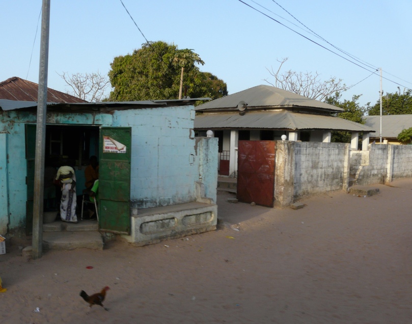
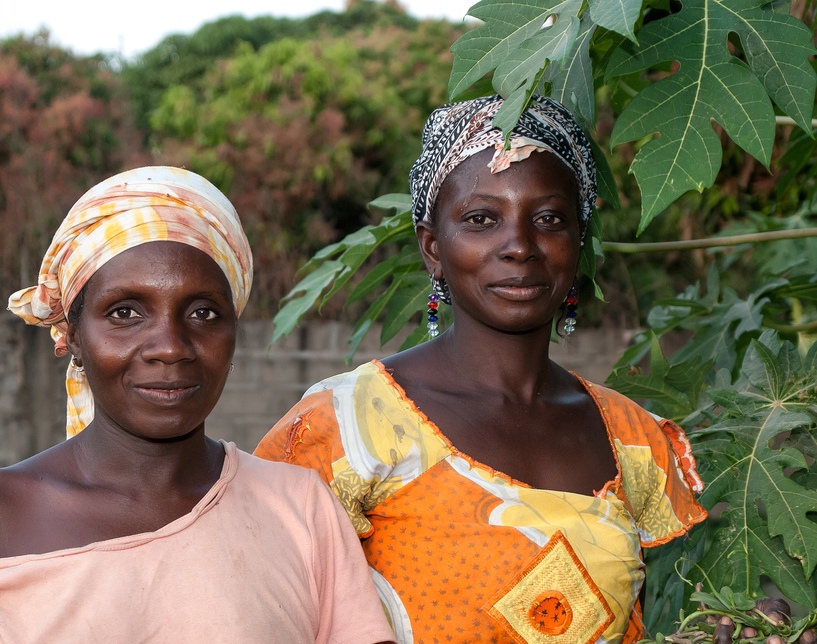
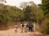
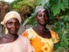
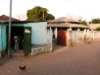 Brufut
village is an old settlement of block compounds with corrugated
metal roofs, resided by mostly Mandinka farmers and vegetable
plots. Increasingly however, land is being sold to private individuals
and estate developers due to the high demand for plots to build
housing space. To get to the original village you take the part
laterite, part dirt road east for a few kilometres. During the
rainy season this road is often dotted with pools of water which
is best suited for four wheel drive cars. Brufut
village is an old settlement of block compounds with corrugated
metal roofs, resided by mostly Mandinka farmers and vegetable
plots. Increasingly however, land is being sold to private individuals
and estate developers due to the high demand for plots to build
housing space. To get to the original village you take the part
laterite, part dirt road east for a few kilometres. During the
rainy season this road is often dotted with pools of water which
is best suited for four wheel drive cars.
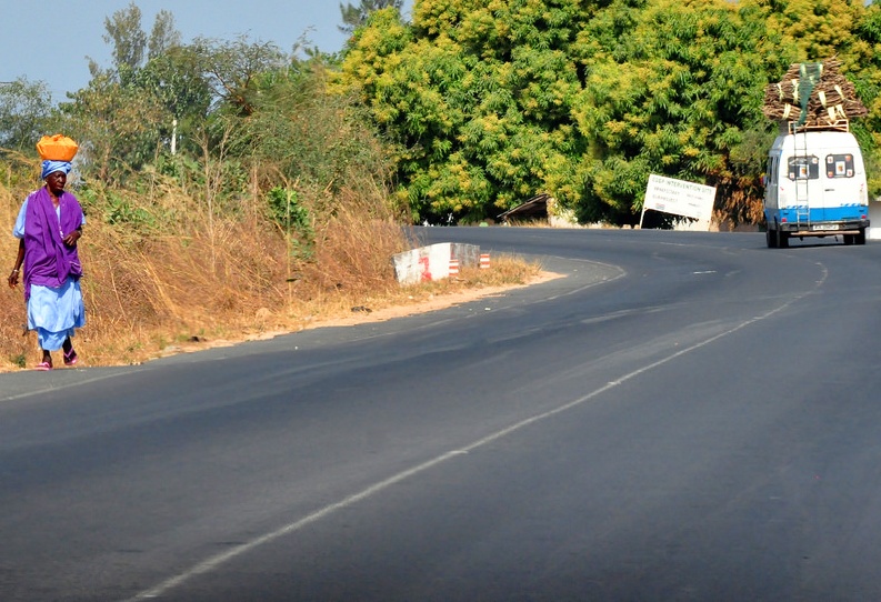
The Atlantic coastal road has seen the installation of road lights
running all the way from the AU Highway at Brusubi
Turntable, and south just short of Ghana Town. Nawec (the electrical
utilities firm) has also laid mains water and electricity cables
that follow the coastal road and are being extended to private
homes.
TOURIST ATTRACTIONS & THINGS TO DO:
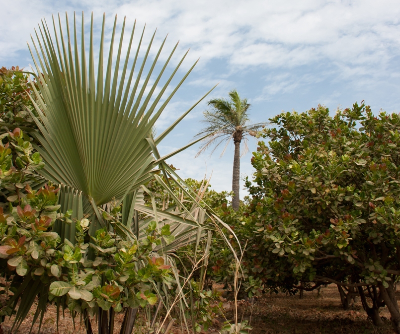
• Bird Watching
 The
Brufut Woods Community Project is a locally managed conservation
area in partnership with the West African Bird Study Association
(WABSA). It is located on the eastern periphery of the village,
some way inland, over some rough back routes. The small nature
reserve has a bird watching hide
specially placed near to an artificial pond. One of the best places
in the woods is an open area near the bridge. The
Brufut Woods Community Project is a locally managed conservation
area in partnership with the West African Bird Study Association
(WABSA). It is located on the eastern periphery of the village,
some way inland, over some rough back routes. The small nature
reserve has a bird watching hide
specially placed near to an artificial pond. One of the best places
in the woods is an open area near the bridge.
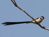 The
resident and inter-African migrant bird species you might see
among the gallery forest and open savannah woodland are the Pin-Tailed
Whydahs, Black Crowned Tchagra, African Scops Owls, Black Kite,
Klaas's Cuckoo, Emerald Cuckoo, Senegal Batis, Osprey, Scarlet-chested
Sunbird, Verreaux's Eagle Owl, Fork-Tailed Drongo, Four-banded
Sandgrouse and the Yellow-throated Leaflove. The
resident and inter-African migrant bird species you might see
among the gallery forest and open savannah woodland are the Pin-Tailed
Whydahs, Black Crowned Tchagra, African Scops Owls, Black Kite,
Klaas's Cuckoo, Emerald Cuckoo, Senegal Batis, Osprey, Scarlet-chested
Sunbird, Verreaux's Eagle Owl, Fork-Tailed Drongo, Four-banded
Sandgrouse and the Yellow-throated Leaflove.
• Sanneh-Mentering
 This
is a holy, sacred site, a more
scenic and evocative place of pilgrimage. A short stroll south
from the Coral Beach (preferably accompanied by a knowledgeable
person from the community) brings you to the cliff-top clearing,
overlooking the beach, with its huge baobab tree and simple hut
in a grove. The stone at the base of the tree is for alms: kola-nuts,
money, cloth. The air is filled with the smell of incense burned
by the incumbent marabout. Muslims from all over The Gambia come
here for good fortune, a more profitable business, health cures
or pray here at a time of crisis in their lives. Women also come
here for a special wash from well water at the bottom of the cliff,
in the hope of overcoming infertility. (The place is also spelt
Sanamentering, Sannehmentering, Sanimentereng
or Sanementereng). This
is a holy, sacred site, a more
scenic and evocative place of pilgrimage. A short stroll south
from the Coral Beach (preferably accompanied by a knowledgeable
person from the community) brings you to the cliff-top clearing,
overlooking the beach, with its huge baobab tree and simple hut
in a grove. The stone at the base of the tree is for alms: kola-nuts,
money, cloth. The air is filled with the smell of incense burned
by the incumbent marabout. Muslims from all over The Gambia come
here for good fortune, a more profitable business, health cures
or pray here at a time of crisis in their lives. Women also come
here for a special wash from well water at the bottom of the cliff,
in the hope of overcoming infertility. (The place is also spelt
Sanamentering, Sannehmentering, Sanimentereng
or Sanementereng).
• Restaurants & Beach Bars
 There
are a number of coastal beach bars such as
Village's Beach Bar, Pelican Bar, Dolphin, Ocean Blue Beach
Bar & Restaurant, Sibis Garden (Chatty's) and Leo's Hotel
Twins Beach Bar serving serving fish domoda with rice, fish in
foil with onions, Barracuda or Ladyfish with rice or chips. They
also have juices and Julbrew beer. There
are a number of coastal beach bars such as
Village's Beach Bar, Pelican Bar, Dolphin, Ocean Blue Beach
Bar & Restaurant, Sibis Garden (Chatty's) and Leo's Hotel
Twins Beach Bar serving serving fish domoda with rice, fish in
foil with onions, Barracuda or Ladyfish with rice or chips. They
also have juices and Julbrew beer.
HEALTH & SAFETY:
The area is safest along the resort's coastal road. Do not venture
into the village on foot alone at night, and do carry a small
torchlight and money belt or pouch.
TRAVEL INFORMATION:
Some mini-buses and yellow taxis travel south into Brufut from
Kololi and Fajara taxi ranks. You will have to change get off
at Brusubi Turntable, and take another taxi towards Brusubi.
 Hotels
Map
Photos
Resorts
Hotels
Map
Photos
Resorts

[Geographical coordinates 13.3833° N, 16.7500°
W / Kombo South, Western Region (WCR)]
|
|
 Attractions
Nature
Reserves
Resorts

Bakau
Banjul
Bijilo
Brufut
Cape
Point
Fajara
Gunjur
Jinack
Island
Kartong
Kololi
Kotu
Makasutu
Sanyang
Serrekunda
Tanji Village

|