INTRODUCTION:
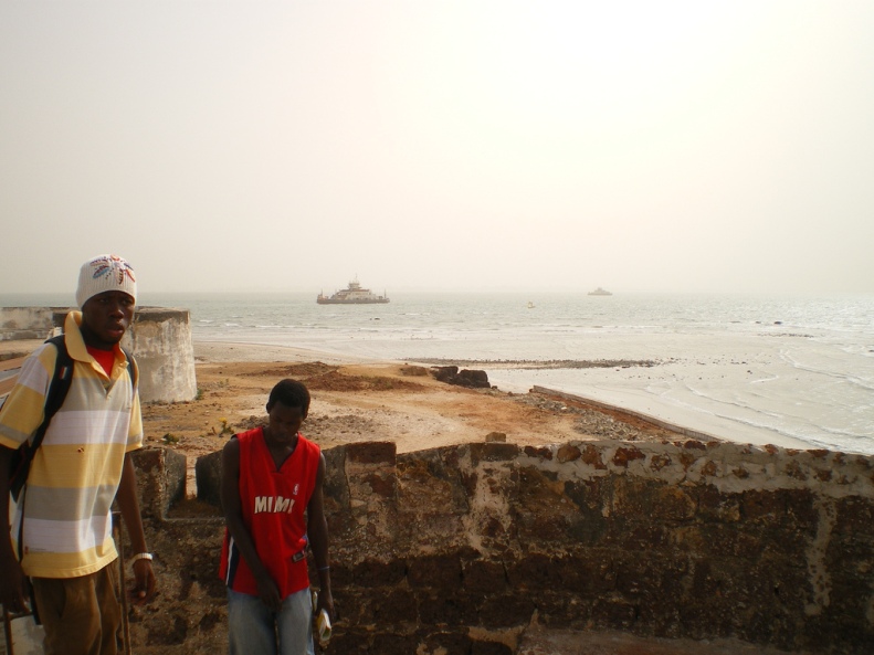
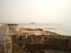
 Fort
Bullen is on the beach, at the estuary of the
River Gambia, and the Atlantic Ocean, in the northwest periphery
of Barra town, known as Barra Point,
in the Lower Niumi District of the North Bank Region. It was built
by the British in 1826 to thwart the efforts of some European
slave traders. In the early 1970s it was declared a National Monument,
and in 2003, along with the Six-Gun Battery in Banjul,
was inscribed as a UNESCO
World Heritage Site. Fort
Bullen is on the beach, at the estuary of the
River Gambia, and the Atlantic Ocean, in the northwest periphery
of Barra town, known as Barra Point,
in the Lower Niumi District of the North Bank Region. It was built
by the British in 1826 to thwart the efforts of some European
slave traders. In the early 1970s it was declared a National Monument,
and in 2003, along with the Six-Gun Battery in Banjul,
was inscribed as a UNESCO
World Heritage Site.
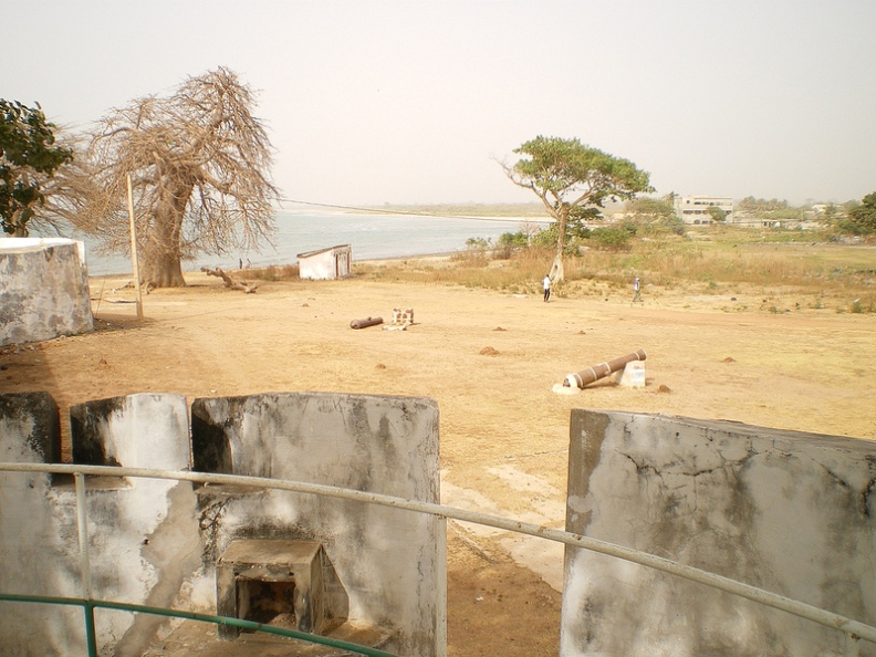
DESCRIPTION:
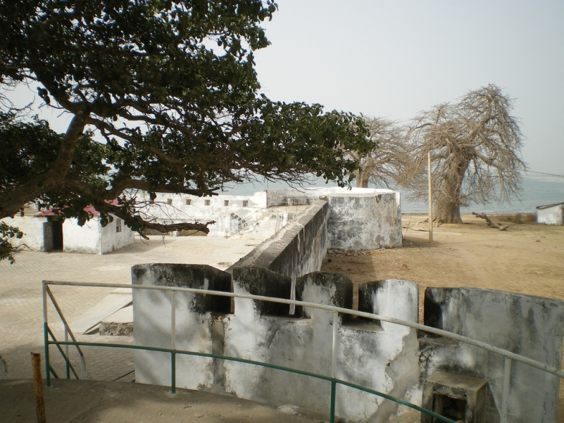
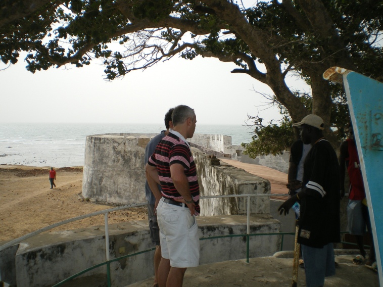
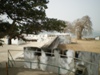
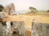
 Fort
Bullen is basically an open rectangular courtyard, fenced in by
low, thick walls of brick or laterite-block, cemented with seashell
lime and patched up with concrete mortar. On each corner of the
walls are circular bastions and embrasures. You can still see
a WWII anti-aircraft gun emplacement in one of the bastions, while
an improvised lighthouse is atop another, and various rusting
cannons litter the beach, while a few are aimed across the river,
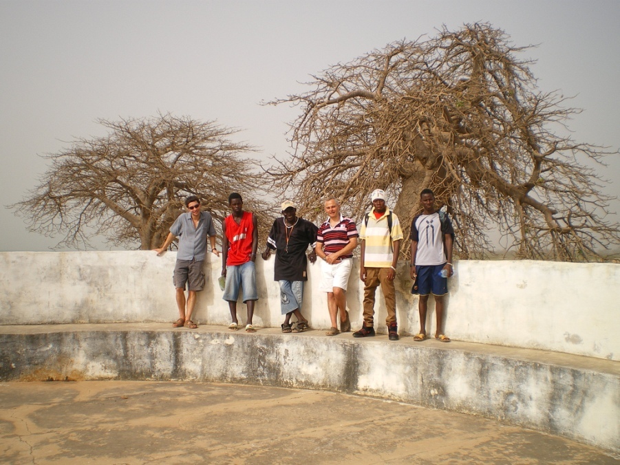
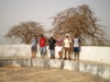
empty. There is a dilapidated, stilted former government rest
house outside the fortress, along with a few baobab
trees and scrub. Fort
Bullen is basically an open rectangular courtyard, fenced in by
low, thick walls of brick or laterite-block, cemented with seashell
lime and patched up with concrete mortar. On each corner of the
walls are circular bastions and embrasures. You can still see
a WWII anti-aircraft gun emplacement in one of the bastions, while
an improvised lighthouse is atop another, and various rusting
cannons litter the beach, while a few are aimed across the river,
empty. There is a dilapidated, stilted former government rest
house outside the fortress, along with a few baobab
trees and scrub.
HISTORY:
 The
construction of Fort Bullen began in 1926, and most historians
believe the present fort was completed around 1833 / 1834. Initially
it was just a few mud huts around a couple of cannons, and a handful
of soldiers. It was built by the British with the specific
aim of preventing the trade in slaves after the passing of the
Abolition Act of 1807 made the slave trade illegal in the British
Empire. The Six-Gun Battery in Banjul
could not cover the 5 kilometre expanse of the River Gambia, and
this allowed Portuguese and French slave traders, who were still
trading with Albreda village, to slip through further north of
the estuary, thus necessitating its construction by Commodore
Charles Bullen. The
construction of Fort Bullen began in 1926, and most historians
believe the present fort was completed around 1833 / 1834. Initially
it was just a few mud huts around a couple of cannons, and a handful
of soldiers. It was built by the British with the specific
aim of preventing the trade in slaves after the passing of the
Abolition Act of 1807 made the slave trade illegal in the British
Empire. The Six-Gun Battery in Banjul
could not cover the 5 kilometre expanse of the River Gambia, and
this allowed Portuguese and French slave traders, who were still
trading with Albreda village, to slip through further north of
the estuary, thus necessitating its construction by Commodore
Charles Bullen.
 Initially
the rulers of Niumi were opposed to the building of the anti-slaving
fort, due to their suspicion that its cannons could be fired against
their stronghold in Essau. However, in 1823 Burungai Sonko, a
troublesome Mandinka, became king, and in 1826 'HMS Maidstone',
together with the steamship the 'HMS African', made an intimidating
presence; the British governor suggested a yearly payment of £100
and Burungai finally relented, and agreed to the north bank's
one mile wide strip of land, ('Ceded Mile') and Barra Point's
fortification on behalf of George IV of England. Two cannons from
Bathurst were installed to begin law enforcement. After 1870 Fort
Bullen appears to have been abandoned, however during World War
2, the 1st Coast Battery took up their positions against a possible
threat from Vichy-allied Senegal. They positioned a 12-pounder
and a 4-inch Vickers and also used the place as a military observation
platform. Initially
the rulers of Niumi were opposed to the building of the anti-slaving
fort, due to their suspicion that its cannons could be fired against
their stronghold in Essau. However, in 1823 Burungai Sonko, a
troublesome Mandinka, became king, and in 1826 'HMS Maidstone',
together with the steamship the 'HMS African', made an intimidating
presence; the British governor suggested a yearly payment of £100
and Burungai finally relented, and agreed to the north bank's
one mile wide strip of land, ('Ceded Mile') and Barra Point's
fortification on behalf of George IV of England. Two cannons from
Bathurst were installed to begin law enforcement. After 1870 Fort
Bullen appears to have been abandoned, however during World War
2, the 1st Coast Battery took up their positions against a possible
threat from Vichy-allied Senegal. They positioned a 12-pounder
and a 4-inch Vickers and also used the place as a military observation
platform.
TOURIST ATTRACTIONS & THINGS TO DO:
 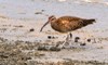
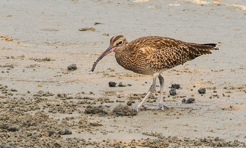
• Bird Watching
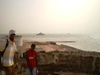
Because the military structure is located on the river mouth and
the Atlantic, with a marine delta to the north, it is a good spot
for birdwatching, where you might
see various migratory, and Palearctic bird species, such as Whimbrels,
African Darters, Royal Terns, Oystercatchers, Sandpipers, Caspian
Terns and Sanderlings.
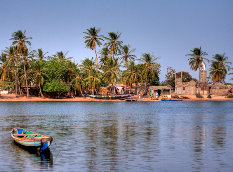
• Jinack Island
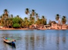 At
low-tide you can stroll from Barra Point across the nearby stream
called the Niji Bolon, and onto Jinack
Island, which has miles of unspoilt beach, and is part of
the Niumi National Park.
While here there are plenty of wildlife spotting opportunities
as well as just relaxing on the 10 kilometre long strand. At
low-tide you can stroll from Barra Point across the nearby stream
called the Niji Bolon, and onto Jinack
Island, which has miles of unspoilt beach, and is part of
the Niumi National Park.
While here there are plenty of wildlife spotting opportunities
as well as just relaxing on the 10 kilometre long strand.
TRAVEL INFORMATION & HOW TO GET THERE:
The fortifications at Barra town
can best be reached by boarding the Banjul to Barra ferry
at the port terminal. Before you go do try and pick up a leaflet
from the NCAC offices at the National
Museum of Gambia on Independence Drive.
See also  Banjul History
Flights
Hotels
Map
Resorts


[Geographical coordinates 13.4733° N, 16.5600° W / Lower
Niumi District, North Bank Region]
|
|
 Attractions
Nature
Reserves
Resorts

Bakau
Banjul
Bijilo
Brufut
Cape
Point
Fajara
Gunjur
Jinack
Island
Kartong
Kololi
Kotu
Makasutu
Sanyang
Serrekunda
Tanji Village
|