Information: & Weather
 The
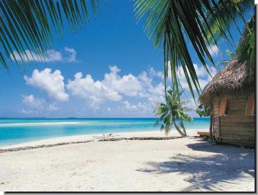
Gambia's climate is a sub-tropical climate with two
variations of distinct dry and rainy seasons. The dry
season generally starts in October and ends around mid-June
each year. The best time of the year to go on holiday
to Gambia is between early November to early April,
when the beaches
are a lot more pleasant for sunbathing. The
Gambia's climate is a sub-tropical climate with two
variations of distinct dry and rainy seasons. The dry
season generally starts in October and ends around mid-June
each year. The best time of the year to go on holiday
to Gambia is between early November to early April,
when the beaches
are a lot more pleasant for sunbathing.
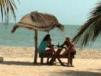 Fanned
by the north-east trade winds the average daytime temperature
along the Atlantic beach hotel resorts
is 24 Centigrade / 75.2 Fahrenheit. The average daytime
temperature for the whole country is 32°C / 91°F. Fanned
by the north-east trade winds the average daytime temperature
along the Atlantic beach hotel resorts
is 24 Centigrade / 75.2 Fahrenheit. The average daytime
temperature for the whole country is 32°C / 91°F.
In the evenings the temperature drops to around 16°C
/ 60°F. Along the western part of the country, known
as he Kombos, temperatures are moderated by Atlantic
Ocean with less seasonal and daily variability in daytime
temperatures. There are about 9 hours of sunshine everyday
with virtually clear skies during the dry spell.
Between January to May the humidity level is at 50-60%.
This period is characterised by several phases. The
first half of this period is generally cool and dry
and the early stages can sometimes be marked by cloudy
days but no rain and there is considerable cooling off
in the evening. The second half is marked by very cool,
dry winds in the evenings and warm sunny days on the
coast
and at the capital.
Up-country, between February and May, the climate is
characterised by the so called Harmattan where the air
is very dry, dusty winds add a haze to the atmosphere
making visibility difficult (50m.) and puts a blanket
of fine dust particles (from the Sahara and Sahel) over
the land. This lasts for around one or two weeks at
a time.
The other distinct climatic season is the rainy season,
known locally as "Nawet", which is caused by the summer
heat causing the air in the Sahara to rise thus creating
an area of low pressure which encourages monsoons as
it meets with the north east trade winds coming of the
Atlantic Ocean in an inter-tropical front. Fog can occur
off the coast when the relatively warm Guinea stream
meets the cooler Canary current. This rainy period starts
around the middle of June and ends around the middle
of October with August being the wettest month of the
year. Relative humidity levels can rise to 95% and temperatures
can reach a skin tingling 43 Celsius / 109.4 Fahrenheit.
The annual precipitation in most parts of the country
is around 51 inches (1,296 Millimetres) and sunny periods
occur on most days. The storms are very often short
and spectacular as huge volumes of rain descend on the
land transforming from brown parched patches to a to
a rich green landscape of foliage. Normally the cloudbursts
occur during the night time and when they occur during
the day they are short-lived leaving clear blue skies.
For birdwatchers
and anglers this is the best time to come and visit
Gambia as the land and wildlife
burst into life.
Be Prepared on Your Holiday:
Because of the rainy conditions at this time of the
year it also becomes the malaria season as mosquito
populations run rampant and it is advisable to rub some
insect repellent particularly during the hours of dusk.
The high humidity in August and September causes the
atmosphere to feel unbearably sticky so when on your
travel excursions
drink plenty of water.
What to wear on Vacation?:
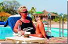 Because
of the hot climate the best clothes to bring along to
Gambia are casual and loose fitting, preferably cotton
shorts and T-shirts for more comfort. A hat is also
recommended as protection against the scorching afternoon
sun. During the winter months the evenings can sometimes
be quite cool and breezy, so a sweater or jacket may
be useful. Because
of the hot climate the best clothes to bring along to
Gambia are casual and loose fitting, preferably cotton
shorts and T-shirts for more comfort. A hat is also
recommended as protection against the scorching afternoon
sun. During the winter months the evenings can sometimes
be quite cool and breezy, so a sweater or jacket may
be useful.
See also  Dress
Code
Dress
Code
| |
|
Average Mean Conditions: |
| Temperature average |
24°C / 75°F |
 |
|
| Day temperatures |
32°C / 89°F |
| |
|
| Night temperatures |
16°C / 61°F |
| |
|
| Sunlight hours |
8.41 |
| |
|
| Daytime humidity |
84% |
| |
|
| Wind speed |
5.77 mph |
| |
|
| Barometer
air pressure |
29.8 |
| |
|
| Rainfall per annum |
1,296 millimetres |
|
Monitoring Base: |
Geographical
coordinates |
Longitude: 16.63
W
Latitude: 13.20 N |
 |