Introduction:
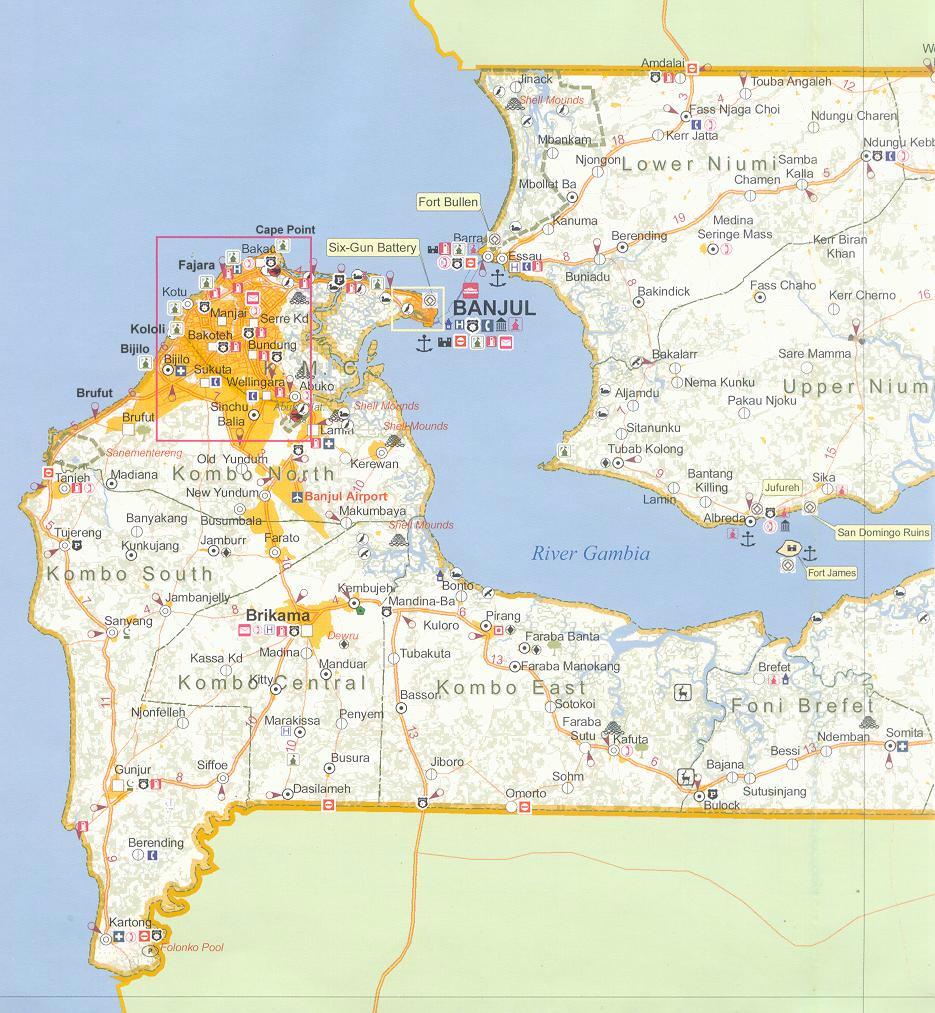
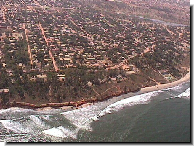
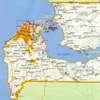
 The Gambia's coastline runs along the West African coast from
the mouth of the Allahein River (13”4’N) to 13’3 1’56”N between
Buniadu Point and the Karenti Bolon; a total length of 80 km (see
map). The west coast, between the Allahein
River and Cape Saint Mary (56 km),
faces the North Atlantic Ocean. The sections of Cape Saint Mary
to Banjul ( 13km) and Barra
Point to Buniada Point (1 km) border the bar area of the Gambia
River estuary which enters the picture between Banjul Point
and Barra Point.
The Gambia's coastline runs along the West African coast from
the mouth of the Allahein River (13”4’N) to 13’3 1’56”N between
Buniadu Point and the Karenti Bolon; a total length of 80 km (see
map). The west coast, between the Allahein
River and Cape Saint Mary (56 km),
faces the North Atlantic Ocean. The sections of Cape Saint Mary
to Banjul ( 13km) and Barra
Point to Buniada Point (1 km) border the bar area of the Gambia
River estuary which enters the picture between Banjul Point
and Barra Point.
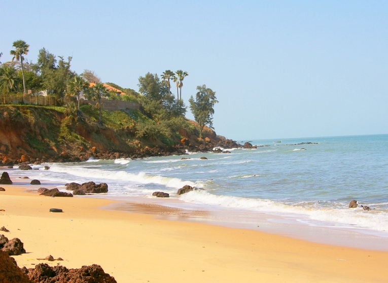
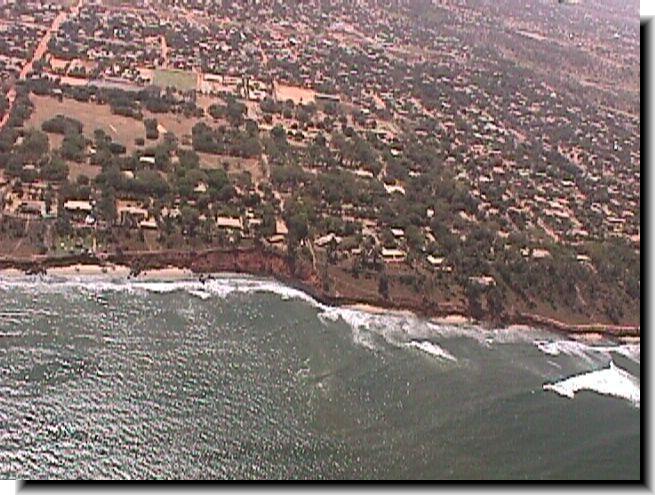
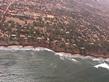
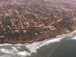
The coastal region is a flat and monotonous area of loose
marine sands; low dunes being being common. These Holocene mineral
deposits are underlain by tertiary ferruginous sandstone of the
"Continental Terminal", which is occasionally laid bare
along the coast as rocky platforms or cliffs. The continental
shelf is relatively narrow, the 200 m isobath being about 80 km
offshore.
 The
Saloum River, with its tributaries, debouches directly North from
the northern border with Senegal, forming the delta-shaped north-eastern
shore of the Gambia estuary; the latter enters its bay-mouth between
Banjul and Barra
Point. A tidal channel runs North and West across the bar with
Shallow sandy banks North of Banjul. The channel and the eastern
bars of the bay have a muddy bottom. The adjacent coastal arc
between Buniadu Point and Barra Point consists of sandy beach
barriers based on finer estuarine deposits, partly sheltered from
the ocean waves by the shallow bar of the estuary. This equally
holds for the fine sandy beach barriers of the western bay-shore
between Banjul an Cape Saint Mary. The
Saloum River, with its tributaries, debouches directly North from
the northern border with Senegal, forming the delta-shaped north-eastern
shore of the Gambia estuary; the latter enters its bay-mouth between
Banjul and Barra
Point. A tidal channel runs North and West across the bar with
Shallow sandy banks North of Banjul. The channel and the eastern
bars of the bay have a muddy bottom. The adjacent coastal arc
between Buniadu Point and Barra Point consists of sandy beach
barriers based on finer estuarine deposits, partly sheltered from
the ocean waves by the shallow bar of the estuary. This equally
holds for the fine sandy beach barriers of the western bay-shore
between Banjul an Cape Saint Mary.
 Southward
of Cape Saint Mary, the coast is
fully exposed to the Atlantic Ocean and displays an echelon-like
arrangement which is related to the differential erosion of the
beaches and the cliffs and rocky
platforms, cut into the sandstone of the “Continental terminal”.
A few small streams have their mouths along this north-south oriented
coastal stretch. The San Pedro or Allahein River, a bit larger,
forms the southern border with Senegal. Southward
of Cape Saint Mary, the coast is
fully exposed to the Atlantic Ocean and displays an echelon-like
arrangement which is related to the differential erosion of the
beaches and the cliffs and rocky
platforms, cut into the sandstone of the “Continental terminal”.
A few small streams have their mouths along this north-south oriented
coastal stretch. The San Pedro or Allahein River, a bit larger,
forms the southern border with Senegal.
Marine Climate Conditions:
The climate of the coastal
zone of The Gambia belongs to the tropical boreal type, with a
long dry season in winter and rains concentrated in summer (July-September);
August is normally the rainiest month. During the wet season 762-l
143 mm of rain may be expected. The country had experienced droughts,
with the rainfall for 1970-1980 dropping to only 345 mm/yr.
On the coast, the intensity of the dry season is lessened by heavy
dew, by high relative humidity, lower temperatures and by sea
breezes. Marine trade winds account for 43 % of the average readings
at Banjul, the (north-easterly) Harmattan for 17%, and the rain-
bearing westerly or north-westerly for 18%, the rest being calms.
Tide is of a semi-diurnal type, with two daily maxima and minima.
The tidal range is relatively small; at Banjul the range is 1.6
m in spring tides and 0.7 m in neap tides. As a consequence, tidal
currents along most of the coast are weak (< 0.1 m/s) except
for the Gambia estuary. Here tidal filling and emptying causes
tidal currents to be well over 1 m/s.
With respect to wave action from the Atlantic Ocean, it can be
observed that the Gambia coast is situated in between the exposed
coasts of Mauritania and Senegal. Affected by northerly to north-westerly
swell regimes - and the more sheltered coasts of Guinee- Bissau
and Guinea - affected by south-south-westerly to west north-westerly
swells. Consequently, along the Gambian coast the north-westerly
swell greatly prevails over the south-westerly ones; its period
varies between 8 and 12 seconds. This swell is strongest during
the dry season.


|
|
Littoral Regime:
 The
NW swell is, thus, the main factor controlling the regional coastal
morphology. It induces a major south-going sedimentary transit
owing to the genegal coast orientation, running in a north-south
direction. The
NW swell is, thus, the main factor controlling the regional coastal
morphology. It induces a major south-going sedimentary transit
owing to the genegal coast orientation, running in a north-south
direction.
The west-east oriented coast in between Cape Saint Mary and Banjul,
however, experiences an east-going littoral drift which is strengthened
by the flood-dominated tidal flows running close to the shore.
These two mechanisms thus promote a littoral drift directed from
Buniadu Point in the North and Cape Saint Mary in the West towards
the estuary mouth, which acts as a sediment sink. This is due
to the fact that the Gambia estuary constitutes a drowned valley
still in the process of being filled up, both from the river and
the sea.
To the South of Bald Cape, the north-south coast again experiences
a predominant south- going littoral drift, as evidenced by the
distinct zeta shape of the beaches in between the various headlands.
Along the SW-NE running coast in between Cape Saint Mary and Bald
Cape, a divergence point in the littoral drift system is thus
apparent, sediment being transported in opposite directions towards
Banjul Point in the north-east, with the estuary acting as sink,
and Kartong Point in the South, where
the accumulation development across Allahein River forms the terminus
of the south going drift.
 As
a consequence, it may be concluded that the whole of this coastal
region has for a long time been in a state of erosion, owing to
its natural development, as induced by the littoral regime and
by sea level rise. Over the past decades, human interventions
also play a significant role. The building construction boom in
the coastal zone which is related to urban developments and particularly
the tourist industry, has led to widespread removal of the natural
vegetation cover and dune formation (rendering the coast more
vulnerable to erosion) and mining of significant quantities of
sand from the beaches, which has
now been halted by the authorities. As
a consequence, it may be concluded that the whole of this coastal
region has for a long time been in a state of erosion, owing to
its natural development, as induced by the littoral regime and
by sea level rise. Over the past decades, human interventions
also play a significant role. The building construction boom in
the coastal zone which is related to urban developments and particularly
the tourist industry, has led to widespread removal of the natural
vegetation cover and dune formation (rendering the coast more
vulnerable to erosion) and mining of significant quantities of
sand from the beaches, which has
now been halted by the authorities.
Estimates of the littoral drift along the open Atlantic coast
have been made on basis of the extensive spit development over
some 20 km at the mouth of the Saloum River (Sangomar spit) and
amount to some 100,000 to 250,000 m”/yr. These figures may equally
be applicable to the coast South of Bald Cape. The mechanism of
sediment transport along the coast to the East of Cape Saint Mary
are complicated by the fact that along this bay coast sheltering
of ocean waves takes place concurrently with increased tidal influence
by flood-dominated flows. From the distinct offshore bar bypassing
at Oyster Creek it may be inferred on the basis of governing rules
for tidal inlets that, the littoral drift along this coastal stretch
must be in the order of 30,000 to 100,000 rn3/yr at most.
Possible sources of sediment for this littoral drift system are
the coast itself through erosion, and the sediment yields from
watersheds into the coastal system. In the latter respect it can
be noted that the Gambia River
constitutes a sink rather than a source of sediments. The remaining
rivers debauching at the coast have too limited catchments to
produce any significant sediment yield. The only major river,
the Allahein River, debouches its sediment yield to the South
of Kartong Point, at the terminus of
the coastal system.
The above appraisal of the littoral drift system and yields of
watersheds imply that on a yearly basis some 200,000 to 300,000
m” of sediment is lost through erosion of the Gambian coast line
in between Banjul Point and
Sanyang Point (the more southern stretch
towards Kartong Point being relatively
stable), i.e. an average erosion of some 1 to 1.5 m/yr along the
entire coastal stretch of 20-25 km. The loss of land is 2.5-3
ha per year.
As the cliffs and rocky platform cut into the sandstone of the
“Continental terminal” are relatively hard (erosion rates 0.5
m/yr), the “production” of sediment through coastal erosion is
even more important along the vulnerable and low sandy beaches.
This is evidenced by the inventory of coastal erosion problems
as given further on.
The above coastal erosion resulting from the overall sediment
balance, is further aggravated by the sea level rise (1 to 1.5
mm/yr) over the past century. Strictly, a change in sea level
does not change the quantity of sediments forming the coastal
system. However, the coastal system reacts with a redistribution
of the sediments, maintaining the cross-sectional profile with
respect to the sea level. At the present rate of sea level rise
the apparent loss of sediments along the Gambian coast line is
preliminary estimated at some 75,000 m”/yr, not yet accounting
for the sediment loss via raising of the coastal plains. The effect
of sea level rise on the coastal sediment balance is thus significant.
 Beaches
Resorts Beaches
Resorts
|