 The
river is "The Gambia", quite literally, the country
exists as a small strip of land area to either side of the river
(see map). It is often
said that "The Gambia River is the Gambia
and the Gambia is the river Gambia". It is a major tourist
attraction and the dominant feature running through the heart
of the country. The
river is "The Gambia", quite literally, the country
exists as a small strip of land area to either side of the river
(see map). It is often
said that "The Gambia River is the Gambia
and the Gambia is the river Gambia". It is a major tourist
attraction and the dominant feature running through the heart
of the country.
This West African waterway is approximately 700 miles (1,130 km)
long+, rising in the Fouta Djallon plateau in Northern Guinea,
flowing generally northwest through SE Senegal then west, dissecting
The Gambia, to the Atlantic Ocean at Banjul.
The river is navigable in most of its length. Ocean-going vessels
can reach Georgetown (Janjangbureh),
about 175 miles (280 km) upstream.
 The
river provides access to interior sections of Senegal and Guinea.
About 70 per cent of its catchment of 77,000 km²
lies less than 100 m above sea level; 30 % below 40 m. The tide
(and navigation) intrudes to 460 km upstream of Banjul
and thus defines the estuary and the greater part of the boundary
between The Gambia an Senegal. The
river provides access to interior sections of Senegal and Guinea.
About 70 per cent of its catchment of 77,000 km²
lies less than 100 m above sea level; 30 % below 40 m. The tide
(and navigation) intrudes to 460 km upstream of Banjul
and thus defines the estuary and the greater part of the boundary
between The Gambia an Senegal.
About 42,000 km² of the catchment
area is situated above the hydrologic station at Gouloumbo (km
492). Of the 35,000 km2 area downstream of this point, 10,500
km are in the Gambian territory.
In 1978, Senegal and The Gambia formed the Gambia River Basin
Development Organization (which was joined by Guinea in 1980)
for the purpose of developing the river’s natural resources. The
objective of the project is to increase agro-forestry and pastoral
output, rationalise tapping of the natural resources and improve
the infrastructures and social services of the project area.
The river ecology is divided into two different zones, estuarine
and freshwater, which in turn largely determine the peripheral
vegetation pattern. Salt water sneaks in some 150km (95mi) upstream,
as far as Kuntaur in the dry season (November to June). In the
lower estuary, mangroves dominate the riverside, with extensive
reed belts in the in-between zone, while where the water is fresh,
the banks are lined with gallery forest.
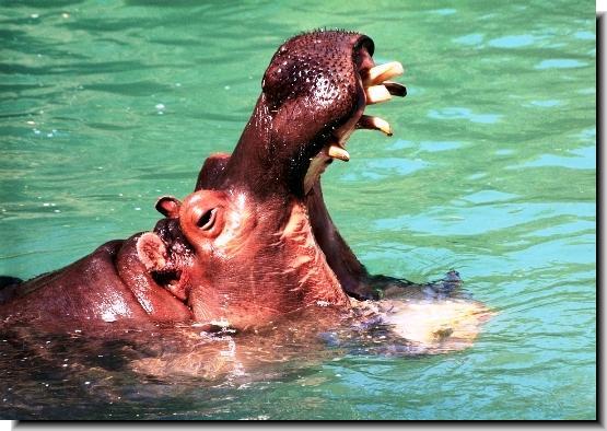
 Wildlife:
Up river, the water wildlife is more
interesting where you can see crocodiles, dolphins and hippos.
The main feature along the river is the incredible variety of
birds and most of the bird trips
are boat trips along the creeks of The Gambia at dawn or dusk.
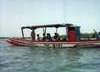
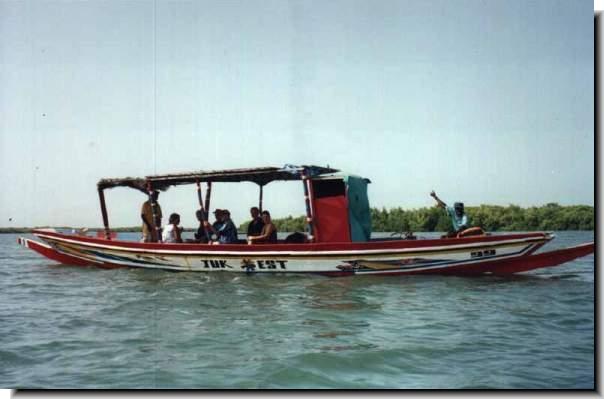
Travel Information:
There are boat trips and fishing voyages,
but too little is now made of the river in tourist terms though
there are tour companies operating
river tours and fishing safaris at the mouth of the river and
upstream. There are camps at Tendaba
and Georgetown specialising in
watching and spotting the amazing variety of species that abound
in this tiny country.
If you travel to Banjul, think
of taking the ferry to Barra
just for the trip and its sights and sounds. Fort
Bullen at Barra Point was built
by the British 200 years ago to cover the approaches to Banjul
and the river, succeeding James
Island Fortress (destroyed by the French) as the main point
of defence in the colony. It can be reached by direct ferry from
the capital. Oyster Creek is
the centre of an area of creeks and waterways which can be visited
from Banjul. This area is part of the Tanbi
Wetlands.
The river is also closely linked with the slave
trade, the remains of slave trading posts can be seen along
its length and the Roots books brought prominence to Albreda near
Juffure Village from where Kunte
Kinte was enslaved. Albreda was the main French trading post
before they withdrew from The Gambia. Nearby is the village of
Juffure, the home of the ancestors of black American writer Alex
Haley, author of ‘Roots’. Visitors who want to see more of the
countryside may cross by ferry
from Banjul to Barra
and travel by road to Juffureh and Albreda (the journey lasts
about 50 minutes), and then by canoe to James
Island in the calm waters of the River Gambia.
The popular tourist destination of Tendaba
is 160km (100 miles) from Banjul by river or road. Further upriver,
the fascinating circles of standing stones around Wassau
have now been identified as burial grounds more than 1200 years
old.
Georgetown was the
'second city' of colonial days, and is still the administrative
and trading centre of the region.
Basse Santa Su is the major
trading centre for the upper reaches of the Gambia River. Handsome
trading houses built at the turn of the century can be seen there.
By the riverside at Perai Tenda can be found a multitude of abandoned
shops formerly operated by European, Gambian and Lebanese merchants
in the days when up-river commerce offered substantial profits
for private traders.
|
|
 Attractions
Nature
Reserves
Resorts

 Abuko
Nature Reserve Abuko
Nature Reserve
Ballabu
Conservation
Bama
Kuno Forest
Bao
Bolong Wetland
Bijilo
Forest Park
Bolong
Fenyo
Kiang
West
Kunkilling
Forest Park
Makasutu Forest
Niumi
National Park
Pirang
Forest
River
Gambia Park
Tanbi
Wetlands
Tanji
Bird Reserve
Tumani
Tenda

|