INTRODUCTION:
 The
Bao Bolong Wetland
Reserve (also spelt Baobolong) was established in 1996, it
covers an area of about 220 square kilometres (84.94 sq. miles),
and is located on the North Bank Region of the River
Gambia. It is100km east of the capital Banjul,
and the estuary, encompassing parts of Upper and Central Baddibu
districts. Bao Bolong Wetland Reserve (BBWR) is the largest protected
reserve in The Gambia; so ecologically significant is the area
that it has been designated a site of international importance
by Ramsar International
Wetlands Convention, the government
having signed it in 1996. The
Bao Bolong Wetland
Reserve (also spelt Baobolong) was established in 1996, it
covers an area of about 220 square kilometres (84.94 sq. miles),
and is located on the North Bank Region of the River
Gambia. It is100km east of the capital Banjul,
and the estuary, encompassing parts of Upper and Central Baddibu
districts. Bao Bolong Wetland Reserve (BBWR) is the largest protected
reserve in The Gambia; so ecologically significant is the area
that it has been designated a site of international importance
by Ramsar International
Wetlands Convention, the government
having signed it in 1996.
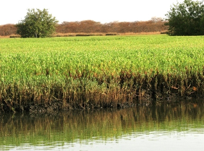
ECOSYSTEMS: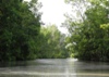
Bao Bolong's 3 distinct ecosystems of mangrove swamp, closed-canopy
savanna woodland, and saltmarsh, are all within close proximity
of each other, and abundant in vegetation, mammals, birds, reptiles,
amphibians and invertebrates.
WATER LEVELS & SALINITY:
 For
about half the year, water in the nature reserve remains brackish.
However, during the rainy season, which runs from about July to
October, rain water is retained by dikes for rice
irrigation. This situation continues until December when the water
level starts to drop again, turning brackish once more. For
about half the year, water in the nature reserve remains brackish.
However, during the rainy season, which runs from about July to
October, rain water is retained by dikes for rice
irrigation. This situation continues until December when the water
level starts to drop again, turning brackish once more.
BACKGROUND HISTORY:
On the 1st January, 1993, an area of 13.514 sq. miles (35 km²)
was initially declared as Bao Bolong National Reserve.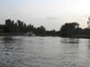 On the 16th September, 1996, the protected area was expanded to
220 km², and became the first and largest wetland reserve in The
Gambia worthy of protection, as noted in the Ramsar Convention,
and was re-named the Bao Bolong Wetland Reserve (Ramsar site no.
860). Note: some sources say the preserve is 200 sq. km. in area.
On the 16th September, 1996, the protected area was expanded to
220 km², and became the first and largest wetland reserve in The
Gambia worthy of protection, as noted in the Ramsar Convention,
and was re-named the Bao Bolong Wetland Reserve (Ramsar site no.
860). Note: some sources say the preserve is 200 sq. km. in area.
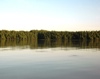
GEOGRAPHY:
The vast 22,000 hectares of the reserve is located opposite the
Kiang West National Park, on the
south bank of the river, and lies to the east of Salikene village
and south of the villages of Mandory, Marong Kunda, N'jaba Kunda,
Minteh, Brang ya, No Kunda and Konteh Kunda Niji. The terrain
is generally flat, with the highest elevation being 11.6 metres
above mean sea level.
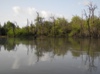
The nature park is named after the Bao Bolon,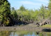 a tributary of the River Gambia, which courses south from northern
Senegal to join the river in a wide low valley on the north bank,
facing Tendaba. The valley enters
Senegalese territory at Kayemore, Ndiao, Marlene,
and passes through the south-east of Niorro and crosses into Gambian
territory through Illiassa. Between the villages of Katchang and
Salikene there are a further 5 tributaries that supply water to
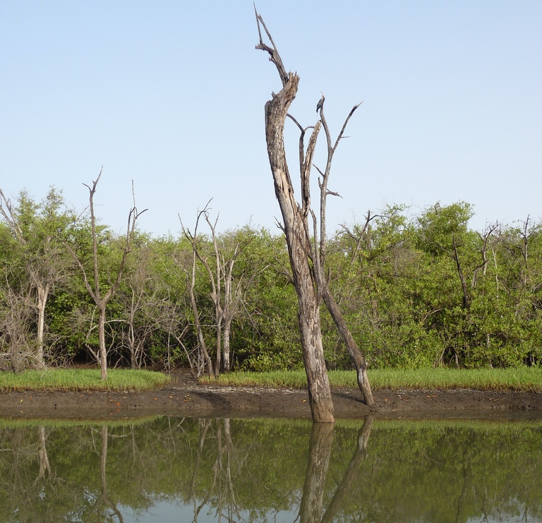
the wetlands. The effect of this is a pristine riverine area that's
a network of brackish creeks fringed by tall stands of mangrove
forest. A little further north of the mangroves and aquatic weeds
the terrain is elevated, rising into a laterite escarpment. Beyond
this are mudflats and lightly wooded areas.
a tributary of the River Gambia, which courses south from northern
Senegal to join the river in a wide low valley on the north bank,
facing Tendaba. The valley enters
Senegalese territory at Kayemore, Ndiao, Marlene,
and passes through the south-east of Niorro and crosses into Gambian
territory through Illiassa. Between the villages of Katchang and
Salikene there are a further 5 tributaries that supply water to
the wetlands. The effect of this is a pristine riverine area that's
a network of brackish creeks fringed by tall stands of mangrove
forest. A little further north of the mangroves and aquatic weeds
the terrain is elevated, rising into a laterite escarpment. Beyond
this are mudflats and lightly wooded areas.
AVIFAUNA:
 The
wetland complex has been deemed an Important Bird Area
(IBA) by Birdlife
International, and increasingly attracts birdwatching
eco-tourists. Among the 268 bird species from 62 families recorded
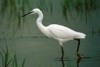
here are resident and migratory avians including waterfowl
such as herons, ducks, egrets, pelicans, Palearctic waders, as
well as raptors and parrots. The preserve is thought to hold over
20,000 waterbirds regularly between August and December. It is
thought to be an important passage site for migrating Common Greenshanks
(Tringa nebularia), Common Ringed Plover (Charadrius hiaticula),
Black-tailed godwit (Limosa limosa) and Black-winged stilt (Himantopus
himantopus). The
wetland complex has been deemed an Important Bird Area
(IBA) by Birdlife
International, and increasingly attracts birdwatching
eco-tourists. Among the 268 bird species from 62 families recorded
here are resident and migratory avians including waterfowl
such as herons, ducks, egrets, pelicans, Palearctic waders, as
well as raptors and parrots. The preserve is thought to hold over
20,000 waterbirds regularly between August and December. It is
thought to be an important passage site for migrating Common Greenshanks
(Tringa nebularia), Common Ringed Plover (Charadrius hiaticula),
Black-tailed godwit (Limosa limosa) and Black-winged stilt (Himantopus
himantopus).

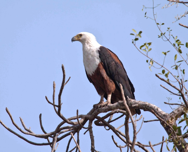
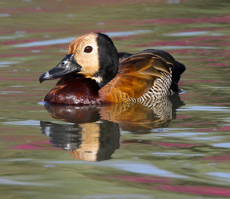
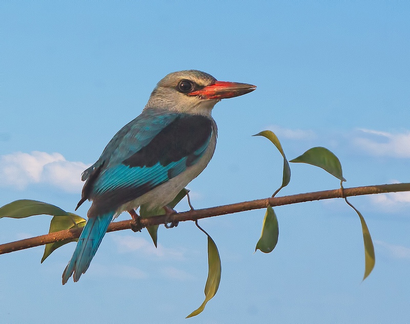
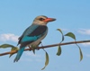
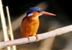
Among the bird species recorded at Bao Bolong Wetland Reserve
are
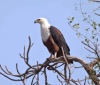 African
Fish Eagles, African Darters, Pygmy Goose, Blue-breasted Kingfishers,
Brown-necked Parrots, Fairy Warblers, Finfoots, Garganey
Ducks, Giant Kingfishers, Knob-billed Ducks, Little Stints, Malachite
Kingfishers, Mouse-brown Sunbirds, Northern Pintails, Northern
Shovelers, Pel's Fishing Owls, Pied Kingfishers, Red-necked Buzzards,
Senegal Thick-knees, Spur-winged Geese, Spur-winged Lapwings,
Striated Herons, Swallow-tailed Bee-eaters, White-backed Night
Herons, Woodland Kingfishers, and White-faced Whistling Ducks. African
Fish Eagles, African Darters, Pygmy Goose, Blue-breasted Kingfishers,
Brown-necked Parrots, Fairy Warblers, Finfoots, Garganey
Ducks, Giant Kingfishers, Knob-billed Ducks, Little Stints, Malachite
Kingfishers, Mouse-brown Sunbirds, Northern Pintails, Northern
Shovelers, Pel's Fishing Owls, Pied Kingfishers, Red-necked Buzzards,
Senegal Thick-knees, Spur-winged Geese, Spur-winged Lapwings,
Striated Herons, Swallow-tailed Bee-eaters, White-backed Night
Herons, Woodland Kingfishers, and White-faced Whistling Ducks.


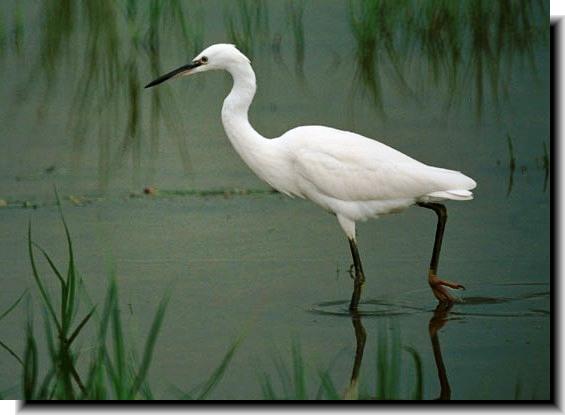
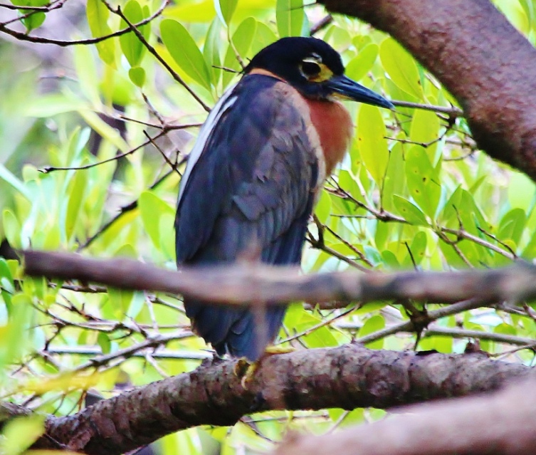
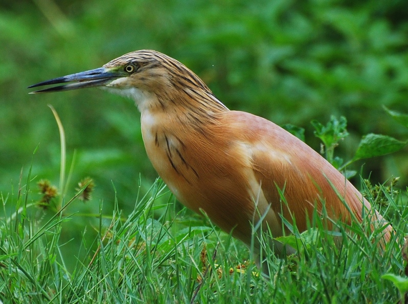
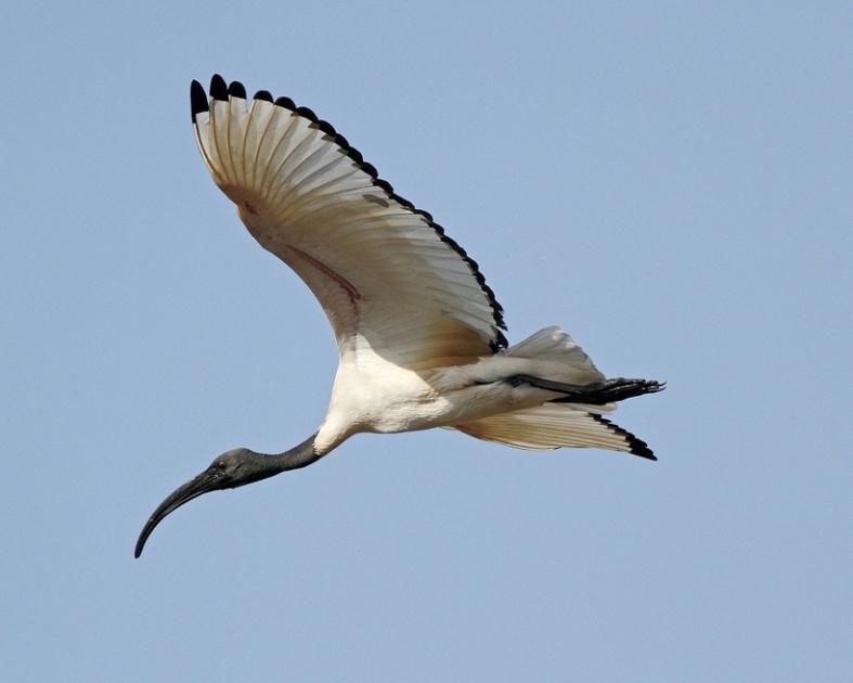
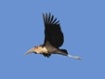
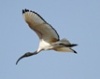
Among the riverine waders feeding along the riverside and creeks
are Goliath Herons, Grey Herons, Woolly-necked storks, Cattle
egrets, Hamerkop, Little Bitterns, Western Reef Herons, Sacred
Ibis, Marabou storks, and Squacco Herons.

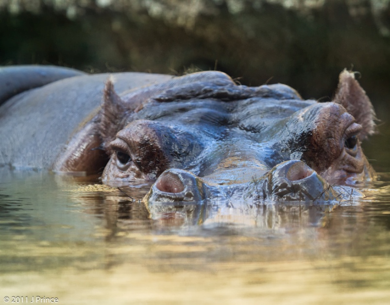
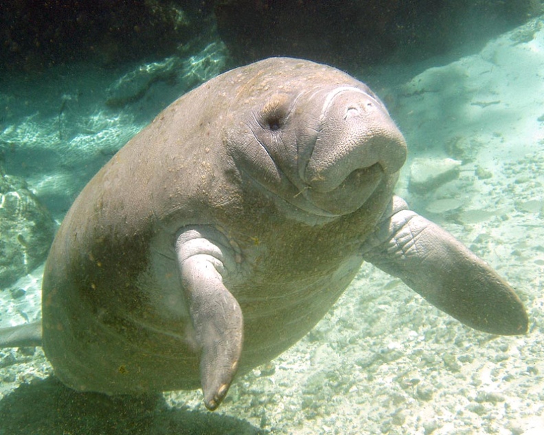
FAUNA:
• Mammals
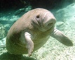
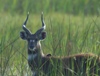 Among
the 32 mammal species recorded at Bao Bolong Wetland Reserve are
antelopes such as Sitatunga (Tragelaphus spekii), bushbuck (Tragelaphus
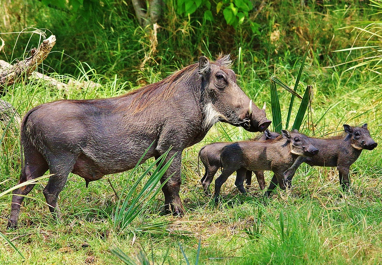
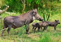
scriptus) and duiker. There are also African / Cape clawless otters
(Aonyx capensis), warthogs, spotted hyenas (Crocuta crocuta),
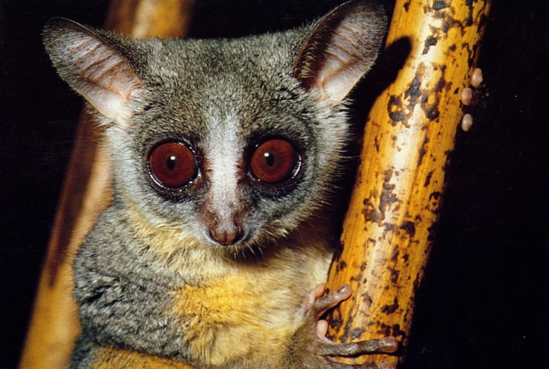
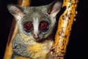
hippopotamus, leopards, primates (Red Colobus, Guinea Baboon,
Patas, the nocturnal Senegal Bushbaby, Green Vervet monkeys),
as well as the rare and endangered West African Manatee
(Trichechus senegalensis). Among
the 32 mammal species recorded at Bao Bolong Wetland Reserve are
antelopes such as Sitatunga (Tragelaphus spekii), bushbuck (Tragelaphus
scriptus) and duiker. There are also African / Cape clawless otters
(Aonyx capensis), warthogs, spotted hyenas (Crocuta crocuta),
hippopotamus, leopards, primates (Red Colobus, Guinea Baboon,
Patas, the nocturnal Senegal Bushbaby, Green Vervet monkeys),
as well as the rare and endangered West African Manatee
(Trichechus senegalensis).
• Fish
 Due
to the extensive network of waterways and mangroves the area is
an important breeding ground for fish fry and juveniles, with
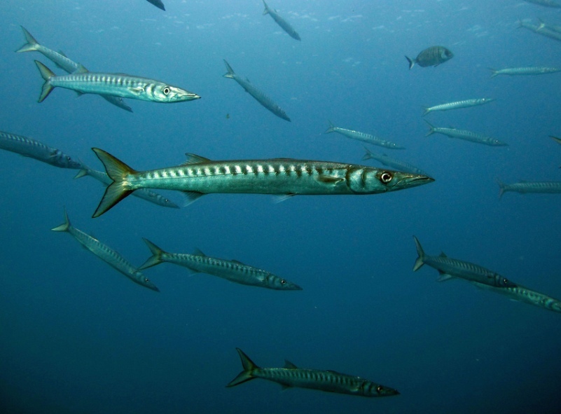
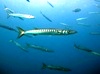
6 families of fish having been recorded here. Among the various
fish species found within the mangrove creeks, tributaries, and
the riverside are Barracuda (Sphyraena sp.), Bobo Croaker (Fonticulus
elongatus), Mullets (Mugilidae, Tilapia, Bonga Shad (Ethmalosa
fimbriata), Giant African Threadfin (Polydactylus quadrifilis),
Catfish (Arius sp.), Pseudotolithus bracygnathus, Pomadasys peroteti
(Cuvier, 1830). There are also molluscs such as Mangrove Oysters
(Crassostrea gasar), and crustaceans such as Blue Crabs (Callinectes
sp.). Due
to the extensive network of waterways and mangroves the area is
an important breeding ground for fish fry and juveniles, with
6 families of fish having been recorded here. Among the various
fish species found within the mangrove creeks, tributaries, and
the riverside are Barracuda (Sphyraena sp.), Bobo Croaker (Fonticulus
elongatus), Mullets (Mugilidae, Tilapia, Bonga Shad (Ethmalosa
fimbriata), Giant African Threadfin (Polydactylus quadrifilis),
Catfish (Arius sp.), Pseudotolithus bracygnathus, Pomadasys peroteti
(Cuvier, 1830). There are also molluscs such as Mangrove Oysters
(Crassostrea gasar), and crustaceans such as Blue Crabs (Callinectes
sp.).
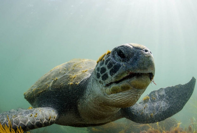
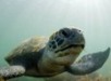
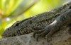
• Reptiles
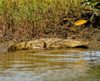 Among
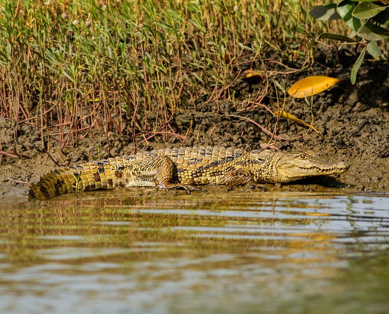
the various types of reptiles are West African crocodiles (Crocodylus
suchus), Dwarf crocodiles (Osteolaemus tetraspis), Nile Monitor
Lizards (Varanus niloticus), Green sea turtles (Chelonia mydas),
and various snakes such as the burrowing
Sand Boa. Among
the various types of reptiles are West African crocodiles (Crocodylus
suchus), Dwarf crocodiles (Osteolaemus tetraspis), Nile Monitor
Lizards (Varanus niloticus), Green sea turtles (Chelonia mydas),
and various snakes such as the burrowing
Sand Boa.
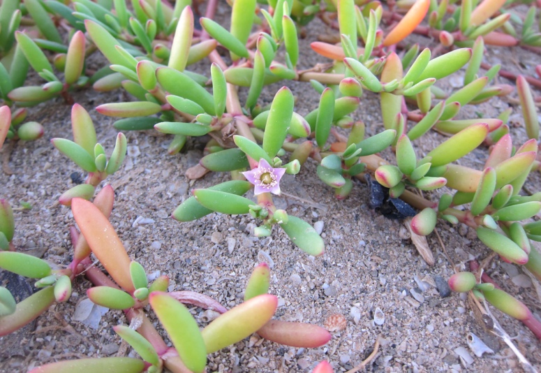
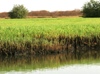
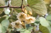
FLORA:
The Bao Bolong Wetland Reserve has a rich patchwork of habitat
types which broadly follow a gradient starting with the high mangroves
of the River Gambia, through permanent salt marsh, bare tannes
and seasonal freshwater marshes, grading finally into wooded grassland.
• Savanna Woodland
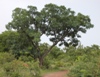 Riparian
and fringing savanna woodland and woodland species include the
African locust bean tree (Parkia biglobosa), West African copal
tree (Daniella Oliveri), Muninga 'kino' (Pterocarpus erinaceus),
Terminalia albida Scott-Elliot, and Red-Flowered Silk Cotton Tree
(Bombax costatum). The principal species of grasses in the grass
savanna with intermittent flooding are Echinochloa pyramidalis,
Phragmites karka, and Cyperus papyrus. Riparian
and fringing savanna woodland and woodland species include the
African locust bean tree (Parkia biglobosa), West African copal
tree (Daniella Oliveri), Muninga 'kino' (Pterocarpus erinaceus),
Terminalia albida Scott-Elliot, and Red-Flowered Silk Cotton Tree
(Bombax costatum). The principal species of grasses in the grass
savanna with intermittent flooding are Echinochloa pyramidalis,
Phragmites karka, and Cyperus papyrus.
 Shrubs
and small trees include the Camel's Foot Tree (Piliostigma thonningii),
Woani (Anthostema Senegalensis), Fig trees (Ficus spp), Terminalia
avicennioides, Pin Cushion or Peach Tree (Nauclea latifolia),
and grass species include Horse Grass (Andropogon tectorum), Gamba
Grass (A. gayanus), Beckeropsis uniseta and Pennisetum subangustum. Shrubs
and small trees include the Camel's Foot Tree (Piliostigma thonningii),
Woani (Anthostema Senegalensis), Fig trees (Ficus spp), Terminalia
avicennioides, Pin Cushion or Peach Tree (Nauclea latifolia),
and grass species include Horse Grass (Andropogon tectorum), Gamba
Grass (A. gayanus), Beckeropsis uniseta and Pennisetum subangustum.
 • Salt-Marsh • Salt-Marsh
This ecosystem supports vegetation such as Shoreline Purslane
(Sesuvium portulacastrum), Brown Beetle Grass (Diplachne fusca),
Salt Grass (Sporobolus spicatus) and Seashore Paspalum or Biscuit
Grass (Paspalum vaginatum).
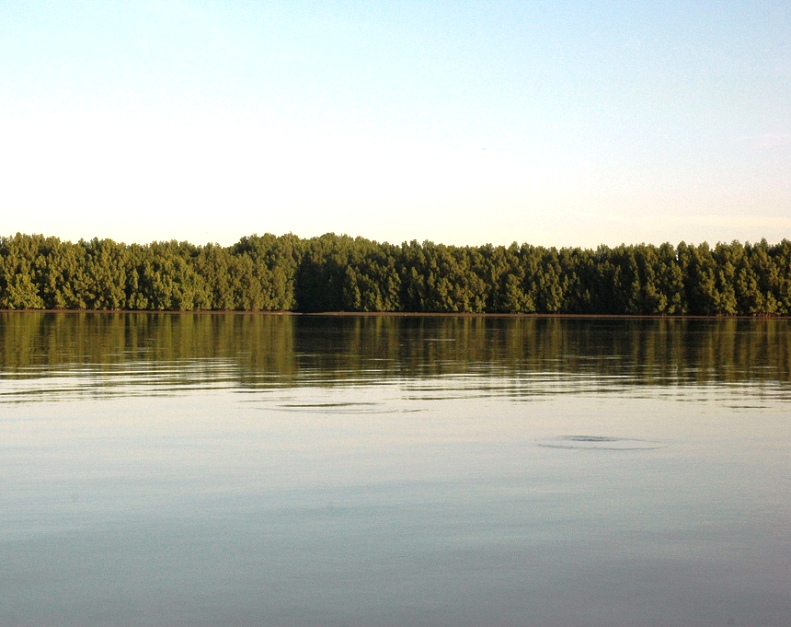
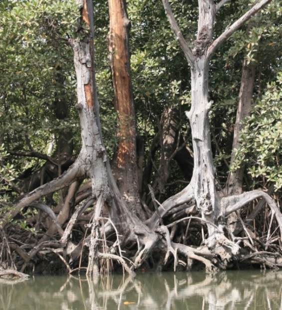
• Mangroves
 The
inter-tidal mangrove forests, which grow as high as 20 metres,
are characterised by stands of Red mangroves (Rhizophora mangle,
Rhizophora racemosa), and Black mangroves (Avicennia africana). The
inter-tidal mangrove forests, which grow as high as 20 metres,
are characterised by stands of Red mangroves (Rhizophora mangle,
Rhizophora racemosa), and Black mangroves (Avicennia africana).
NATURE TRAIL & EXCURSIONS:
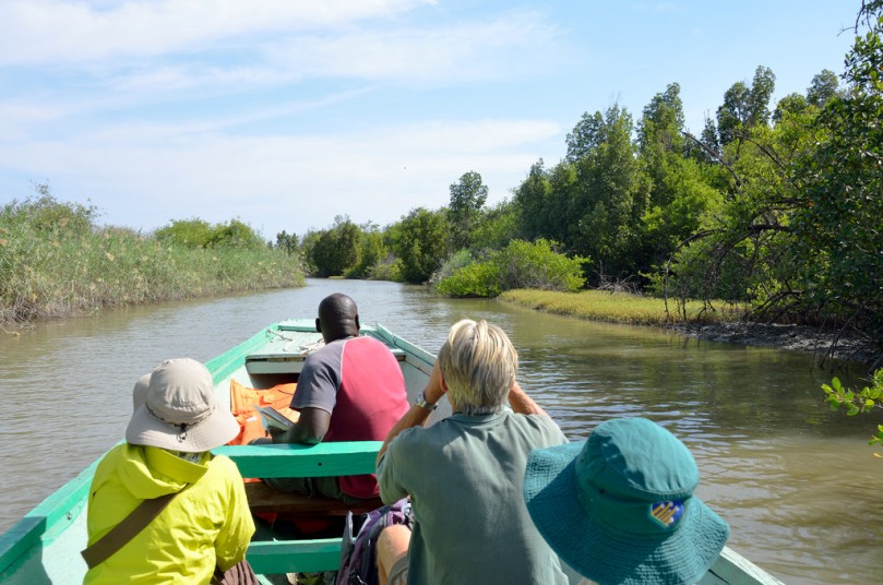
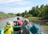
The Bao Bolong Wetland Reserve is attracting an increasing number
of eco-tourists to The Gambia, especially bird watchers. The simplest
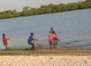
way to visit is to go on an African pirogue river excursion run
by the Tendaba Camp.
Departing from the camp you would first cross to the opposite
side of the River Gambia, then on to the creeks called the Tunku
and Kisi bolongs, where you can spot various bird species nearby.
If you are really patient you might also see West African crocodiles
or Nile monitor lizards.
 The
other alternative excursion route is via the north of the park
using a 4 wheel drive car. From the village of No Kunda you can
take a dirt track from the North Bank Road, and head south for
a few kilometres to the headquarters of the reserve, at a place
called Dai Mandinka. The staff there can assist you on guided
tours or find a fisherman willing to take you on a dugout canoe
trip along some of the bolongs. The
other alternative excursion route is via the north of the park
using a 4 wheel drive car. From the village of No Kunda you can
take a dirt track from the North Bank Road, and head south for
a few kilometres to the headquarters of the reserve, at a place
called Dai Mandinka. The staff there can assist you on guided
tours or find a fisherman willing to take you on a dugout canoe
trip along some of the bolongs.
It is perhaps best that you make prior arrangements to go and
visit the complex with the
Department of Parks & Wildlife Management (DPWM) at Abuko.
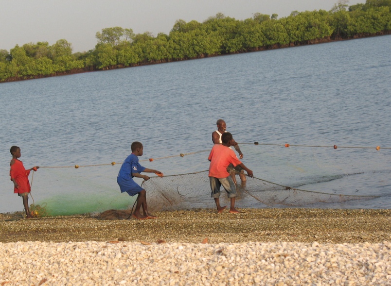
RESIDENT HUMAN COMMUNITIES:
 The
reserve's resources are used by people from the internal and peripheral
villages, and the rural Senegalese settlements to the north. Rice
farming is widespread. Cattle graze throughout the open areas
during the rains and early dry season. Later in the dry season
swathes of tall swamp vegetation are cut for fencing and roofing.
The felling of mangroves for wood has been discouraged with the
help of staff from Kiang West National
Park. The conservation area is susceptible to deterioration
through the expansion of grazing, hunting and agriculture. The
reserve's resources are used by people from the internal and peripheral
villages, and the rural Senegalese settlements to the north. Rice
farming is widespread. Cattle graze throughout the open areas
during the rains and early dry season. Later in the dry season
swathes of tall swamp vegetation are cut for fencing and roofing.
The felling of mangroves for wood has been discouraged with the
help of staff from Kiang West National
Park. The conservation area is susceptible to deterioration
through the expansion of grazing, hunting and agriculture.
ACCOMMODATION:
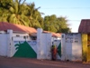 There
are no lodgings inside the reserve itself. The nearest rooms can
be found at either Farafenni or south across the river at Tendaba.
In Farafenni there is the Ballanghar Motel with 11 basic rooms
with fans around a yard (tel: 7735431). According to the Rough
Guide the best-known place to stay is Eddy's Hotel, Bar &
Restaurant. The rooms here have en-suite showers, WC with optional
fan or AC (tel: 7735611 / 7735225 / 5735225). There are a few
small local restaurants such as Assane's and Sunnu Yai which cooks
good quality chicken, steak and chips along with cold soft drinks
and beer. There
are no lodgings inside the reserve itself. The nearest rooms can
be found at either Farafenni or south across the river at Tendaba.
In Farafenni there is the Ballanghar Motel with 11 basic rooms
with fans around a yard (tel: 7735431). According to the Rough
Guide the best-known place to stay is Eddy's Hotel, Bar &
Restaurant. The rooms here have en-suite showers, WC with optional
fan or AC (tel: 7735611 / 7735225 / 5735225). There are a few
small local restaurants such as Assane's and Sunnu Yai which cooks
good quality chicken, steak and chips along with cold soft drinks
and beer.
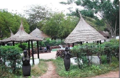
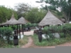 Perhaps
the most pleasant place to stay in the area is the upriver resort
called Tendaba
Camp. It is located in Kwinella, on the other side of the
reserve, along the southern bank of the river. They have their
own boats so getting to the preserve is fairly easy. They have
160 beds in two types: basic rooms, and riverside ensuite deluxe
rooms. These last set of rooms each has a private shower, toilet
and sink as well as air-conditioning. Perhaps
the most pleasant place to stay in the area is the upriver resort
called Tendaba
Camp. It is located in Kwinella, on the other side of the
reserve, along the southern bank of the river. They have their
own boats so getting to the preserve is fairly easy. They have
160 beds in two types: basic rooms, and riverside ensuite deluxe
rooms. These last set of rooms each has a private shower, toilet
and sink as well as air-conditioning.

TRAVEL INFORMATION & HOW TO GET THERE:
 To
get to Bao Bolong by road you go the the Gambia's capital of Banjul,
then board the ferry to
Barra in the NBR. From the town
you make your way east along the North Bank Road, past Kerewan
and onto No Kunda. From here you take the southbound access route. To
get to Bao Bolong by road you go the the Gambia's capital of Banjul,
then board the ferry to
Barra in the NBR. From the town
you make your way east along the North Bank Road, past Kerewan
and onto No Kunda. From here you take the southbound access route.
See also safety.
CONTACT ADDRESS DETAILS:
Department of Parks & Wildlife Management
Abuko Nature Reserve, HQ
C/o Ministry of Forestry &
the Environment
GIPFZA House, Kairaba Avenue
The Gambia, West Africa
Tel no: +220 4376973
9817559
3917559
Email: info@mofen.gov.gm
[Geographical coordinates 13.5167° N, 15.8667° W / Upper
& Central Baddibu, North Bank Region]
 

|
|
 Attractions
Nature
Reserves
Resorts

 Abuko
Nature Reserve Abuko
Nature Reserve
Ballabu
Conservation
Bama
Kuno Forest
Bao
Bolong Wetland
Bijilo
Forest Park
Bolong
Fenyo
Kiang
West
Kunkilling
Forest Park
Makasutu Cultural Forest
Niumi
National Park
Pirang
Forest
River
Gambia Park
Tanbi
Wetlands
Tanji
Bird Reserve
Tumani
Tenda


|